Book chapter | Archaeology and WW1 remembrance

(IGI Global, 2020)

The Contribution of Archaeology to WWI Commemoration in Flanders

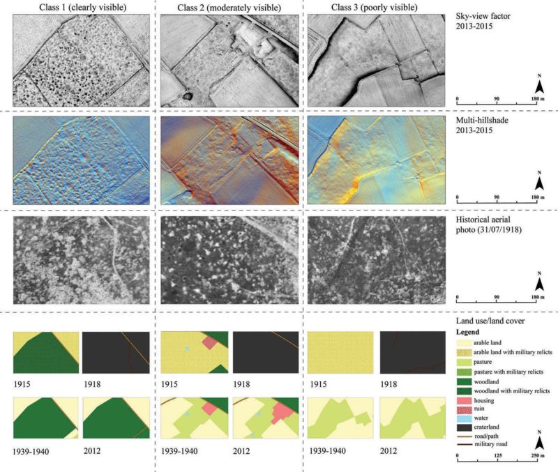
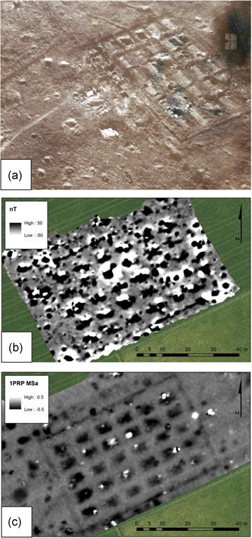
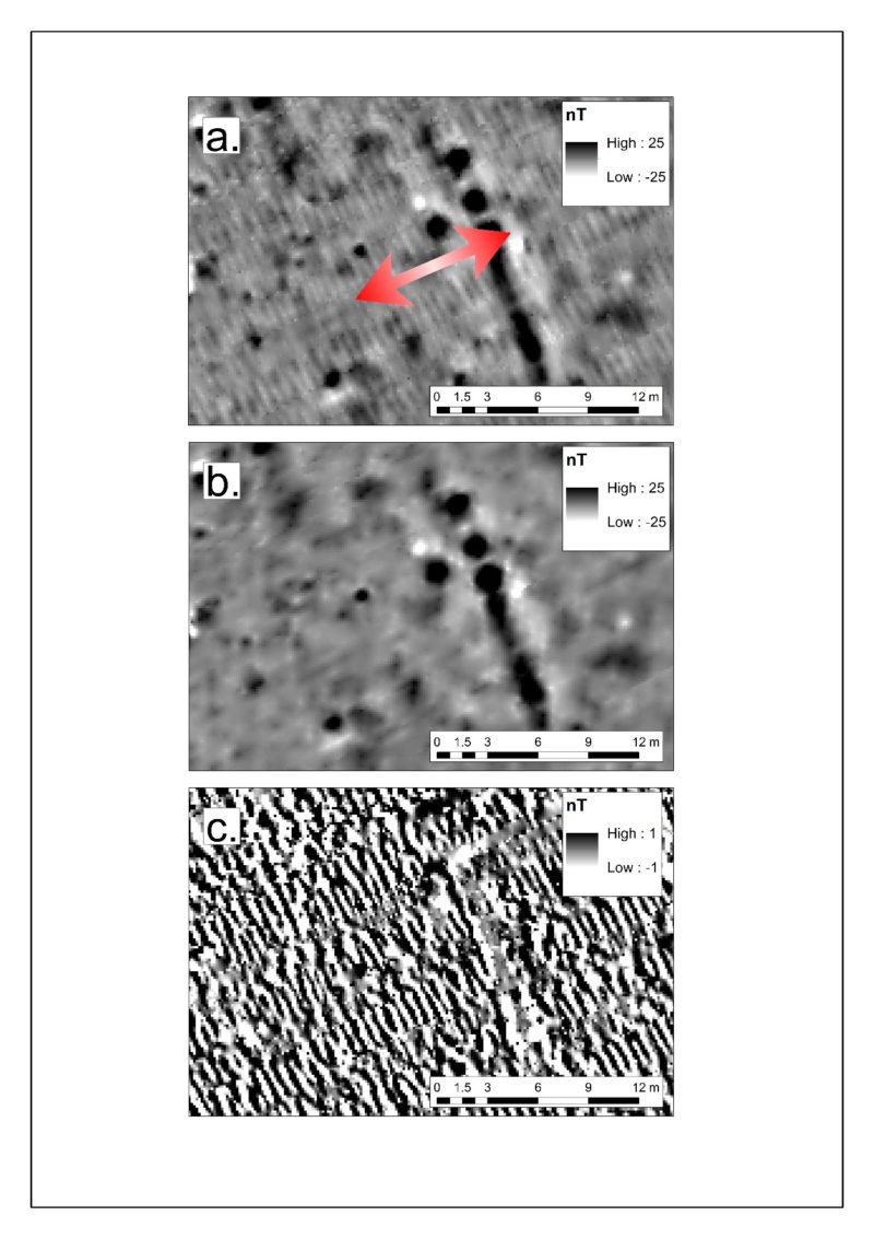
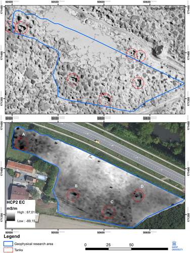
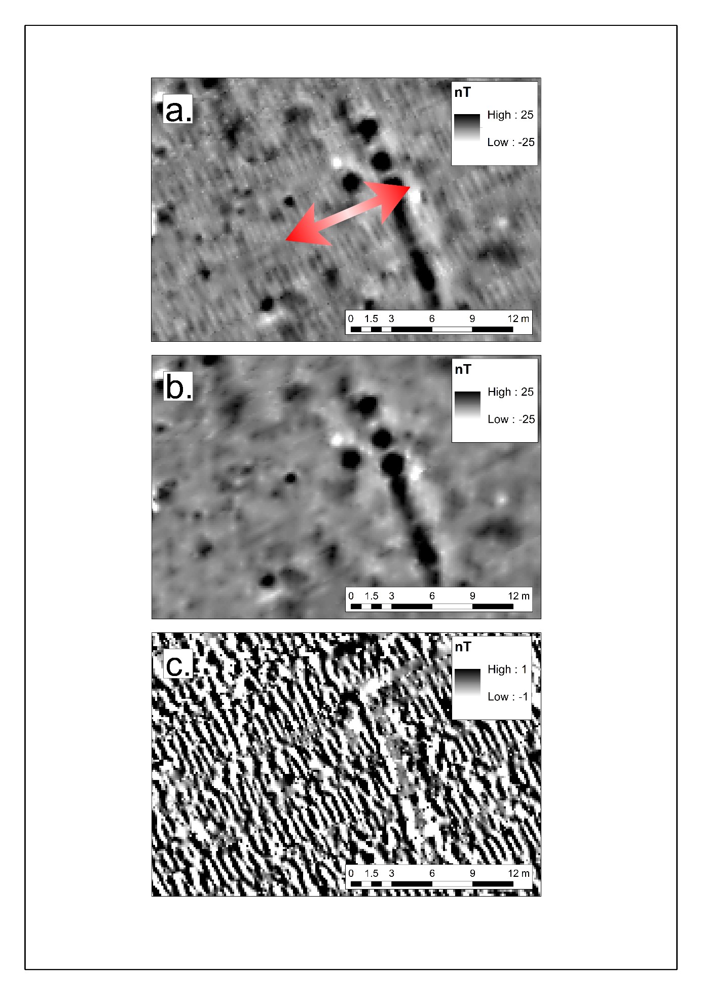
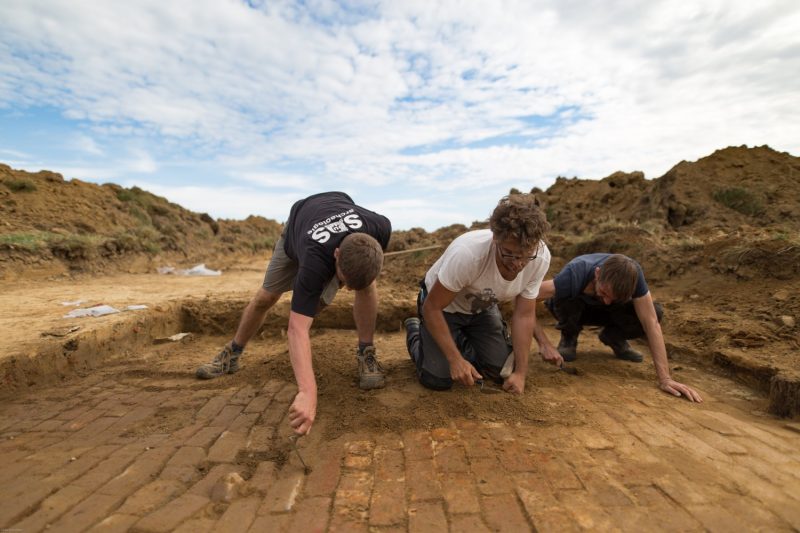
When the First World War ended, the landscape had been transformed into a wasteland. Later, the population faced the challenge of rebuilding the region. Many traces of the war were then wiped out. Everywhere, the archaeological remains are slumbering in the soil, barely 30 cm deep and invisible to the visitors. It took a while before the remains of the war have been considered as archaeological heritage. It was not until 2002-2004 that professional archaeologists in Belgium began to show an interest in this special heritage. Since then, the importance of this archaeology has only increased and today it is part
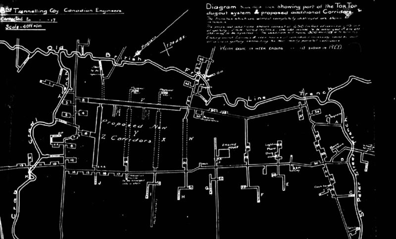
of mainstream archaeological research. Several initiatives built on the successful first commemorative year 2014 in Belgium, with record numbers of visitors in the Westhoek. During the commemorations, various archaeological projects were put in the spotlight and were picked up with great interest from the public. This chapter highlights a series of high-profile initiatives that shaped specific parts of the remembrance of the First World War in Belgium.

Reference:

Stichelbaut, B., J. Bourgeois, G. De Mulder, S. Verdegem and W. Gheyle (2020) The Contribution of Archaeology to WWI Commemoration in Flanders. In Enrico, P. (ed.), Developing Effective Communication Skills in Archaeology (pp. 154-182). Hershey, PA, USA: IGI Global.


Dan.J.Geo | First World War shell hole landscapes

Classes of visibility of the shell holes determined with sky-view factor and multi-hillshade visualizations of the Flemish DHMVII 1 m raster DEM with accompanying historical aerial photos from 1918 and land use/land cover maps of the present-day landscape (photos copyright In Flanders Fields Museum)

(Danish Journal of Geography, 2018)

Revealing the preservation of First World War shell hole landscapes based on
a landscape change study and LiDAR

The surface scars of the First World War (WWI; 1914-1918) are rapidly disappearing due to modern and fast changing landscapes. Therefore, there is a need to monitor landscape relicts that mark our past. This study examines depressions caused by shelling. These shell holes are still present today and are one of the last remains of the military impact during the 4 years long stalemate on the Western Front. Shell hole landscapes are until now overlooked in landscape research and little attention is given to the causes behind the absence or presence of these shell holes in the present-day micro-topography. This paper aims to identify these causes by using digital interdisciplinary techniques on a landscape scale: Light detection and ranging (LiDAR) giving insights into the presence of the shell holes today, landscape maps indicating the evolution of land use/land cover in the past century and a shell hole density map representing the situation of 1918. Results revealed that the WWI shell hole landscape is still abundantly present today, and where it has disappeared, a direct link was found to land use/land cover transformations and the intensity level of cultivated fields from past to present. To work towards a sustainable management of WWI heritage, these findings are indispensable.

Reference:

Van den Berghe, H., Gheyle, W., Note, N., Stichelbaut, B., Van Meirvenne, M., Bourgeois, J., & Van Eetvelde, V. (2018). Revealing the preservation of First World War shell hole landscapes based on a landscape change study and LiDAR. Geografisk Tidsskrift-Danish Journal of Geography, 1-14.

Link to free e-print (PDF): https://www.tandfonline.com/eprint/En3ucajRYUjUNC5bNNQu/full

Geoarch. | Magnetometry and EMI on WW1 battlefields

A WW1 barrack camp detected using three techniques:
(a) an oblique aerial photograph taken in September 1918 (copyright
IFFM collection); (b) an FGM survey conducted in March 2015; (c) a
magnetic data layer from an EMI survey conducted in September 2016.

(Geoarchaeology, 2018)

Evaluation of fluxgate magnetometry and electromagnetic induction surveys for subsurface characterization of archaeological features in World War 1 battlefields

Geophysical prospection as a noninvasive archaeological survey technique has become a widely applied discipline that is currently finding its way into the former World War 1 (WW1) battlefields. Because of the imminent danger of unexploded ordnances, noninvasiveness is the key to exploring the subsurface containing our buried heritage. Fluxgate magnetometry (FGM), a frequently applied prospection technique in archaeology and unexploded ordnance detection, is not always satisfactory in this area. This is due to the high density of ferrous objects masking the underlying features of interest. Frequency domain electromagnetic induction (EMI) has proved to be less sensitive to metal objects, thereby revealing more WW1 traces. Another advantage of EMI is that soil disturbances related to shelling and metal objects can be classified with higher precision by combining magnetic and electrical conductivity data layers. After evaluating both prospecting techniques on maximum feature coverage, feature type identification, metal object filtering, and localization, EMI was shown to be the most successful. Although FGM is not inferior (providing high survey speed and density with multisensor arrays and reliability in pinpointing features, etc.) overall, EMI is the preferred option on sites with heavily disturbed soil. In this paper, these findings will be demonstrated with survey examples, case studies, and numerical analyses from the WWI battlefields of Flanders.

Reference:

Note, N., Saey, T., Gheyle, W., Stichelbaut, B., Van den Berghe, H., Bourgeois, J., Van Eetvelde, V., & Van Meirvenne, M. (2018). Evaluation of fluxgate magnetometry and electromagnetic induction surveys for subsurface characterization of archaeological features in World War 1 battlefields. GeoArchaeology.

https://onlinelibrary.wiley.com/doi/full/10.1002/gea.21700

Arch.Prosp. | World War I Tanks in the Ypres Salient

Comparison between historical aerial photograph (27 may 1918, IWM box 154 10B 968) and geophysical soil sensing at Clapham junction

(Archaeological Prospection, 2018)

The archaeology of world war I tanks in the Ypres Salient (Belgium): A non-invasive approach

In the past decade, the research of archaeological remains from World War I has become mainstream. This article uses non-destructive techniques to investigate the possible material remains of tank warfare in Belgium. During World War I, tanks were used for the first time as a ‘land battleship’ in order to break through the stalemate in the trenches. During the Battle of Messines and the Third Battle of Ypres (1917), tanks were used in Belgium to assist a large-scale Allied offensive. The offensive was a complete failure and besides the terrible human cost, many of the tanks became derelict in so-called ‘tank cemeteries’. This article combines historical information, contemporary historical aerial photographs and state-of-the-art geophysical soil sensing to assess the distribution, density and possible material remains of the tank war. Aerial photo-interpretation and geographic information system (GIS)-mapping sheds new light on the location of 97 tank wrecks in the Ypres Salient. Two sites were selected for further geophysical research. By using electromagnetic induction, it was possible to identify the remains of five tanks as geophysical anomalies, which corresponds to a debris field spread. In this article, both non-invasive and non-destructive techniques will demonstrate the significant potential for investigating cases on a landscape scale without any intense interference of the highly disturbed topsoil.

Reference:

Stichelbaut, B., Note, N., Van den Berghe, H., Van Eetvelde, V., Van Meirvenne, M., Bourgeois, J., & Gheyle, W. (2018). The archaeology of First World War tanks in the Ypres Salient (Belgium): a non-invasive approach. Archaeological Prospection.

https://onlinelibrary.wiley.com/doi/abs/10.1002/arp.1722

Book chapters | Traces of War. The Archaeology of the First World War

Birger Stichelbaut et al. 2018. Traces of War. The Archaeology of the First World War.

(Cannibal Publishing, 2018)

Traces of War. The Archaeology of the First World War

Archaeological remains found at the front are throwing a new light on the Great War

At the end of the First World War, the landscape of the Western Front in Flanders had been transformed into a wasteland. After the war, the population returned, faced with the enormous challenge of rebuilding the region and making it inhabitable again. All traces of the war were wiped out, leaving only what was left in the ground – what is now the archaeological soil archive. Throughout the Westhoek, 30 centimetres beneath the ground and invisible to the naked eye, the archaeological remains of the war lie dormant.

This book, the first of its kind, is a compendium of the findings of ten years of First World War archaeology in Belgium. Clearly written, it looks at many spectacular finds resulting from excavations at more than 150 sites in the front-line region, and also delves into the unexpected role of the landscape as the last witness of the war. These material remains from military camps, hospitals and trenches illustrate day-to-day life at the front, while also looking at the personal fates of several of the fallen soldiers – and many horses.

This book is published to coincide with the exhibition of the same name in the In Flanders Fields Museum, Ypres, Belgium (until 30 September 2018). Four chapters feature results from our research project.

Reference:

Stichelbaut, B. (ed.), 2018. Traces of War. The Archaeology of the First World War.  Veurne: Hannibal, 192 pages (published in English and in Dutch]

http://www.uitgeverijkannibaal.be/traces-of-war-the-archaeology-of-the-first-world-war

http://www.uitgeverijkannibaal.be/catalogus-hannibal/sporen-van-oorlog-archeologie-van-de-eerste-wereldoorlog (Dutch version)

  • Gheyle, W., Stichelbaut, B., Note, N., Saey, T., Van den Berghe, H., Van Meirvenne, M., . . . Bourgeois, J. (2018). Scanning the landscape with lasers. In B. Stichelbaut (Ed.), Traces of War. World War 1 Archaeology (pp. 156-163). Veurne: Hannibal
  • Gheyle, W., Note, N., Saey, T., Van den Berghe, H., Van Meirvenne, M., Van Eetvelde, V., . . . Stichelbaut, B. (2018). Using geophysical sensors to look under the ground. In B. Stichelbaut (Ed.), Traces of War. World War 1 Archaeology (pp. 164-169). Veurne: Hannibal
  • Bracke, M., Gheyle, W., & Stichelbaut, B. (2018). Just behind the front line. In B. Stichelbaut (Ed.), Traces of War. World War 1 Archaeology (pp. 84-99). Veurne: Hannibal
  • Bracke, M., Gheyle, W., Hoorne, J., & Stichelbaut, B. (2018). Archaeological finds in the hinterland: far from the front, but close to the war. In B. Stichelbaut (Ed.), Traces of War. World War 1 Archaeology (pp. 124-137). Veurne: Hannibal


Landscape Research | Great War relics in the present-day landscape

Location of the study areas. Source: © EuroGeographics (2013)

(Landscape Research, 2018)

Using the past to indicate the possible presence of relics in the present-day landscape: the Western Front of the Great War in Belgium

The First World War (WWI) had a notable influence on the landscape at the former Western Front in Belgium. Research on a landscape scale is necessary to understand the destructive and constructive impact of the war and its consequences for the post-war landscape in a holistic manner. This paper focuses on the trajectory and impact analysis of three study areas with contrasting landscape types and aims to indicate possible preserved military relics today. Therefore, landscape changes are studied using historical aerial photographs (WWI and WWII) and contemporary orthophotos. A military landscape characterisation is made based on land use/land cover and linear structures that were mapped throughout time. Specific landscape trajectories could be designated as areas with a possible preservation of WWI heritage, with a related impact degree. The results are useful for sustainable heritage management and for further interdisciplinary research on WWIheritage, by providing a broad knowledge of the area.

Reference:

Van den Berghe, H., Gheyle, W., Stichelbaut, B., Saey, T., Note, N., Van Meirvenne, M., Bourgeois, J., & Van Eetvelde, V. (2018). Using the past to indicate the possible presence of relics in the present-day landscape: the Western Front of the Great War in Belgium. Landscape Research

http://www.tandfonline.com/doi/full/10.1080/01426397.2017.1415315

Link to free e-print (PDF): https://www.tandfonline.com/eprint/N62zwbZvAVcIsZba2X6Q/full

Geoderma | World War One’s devastated front zone: shell hole density map

Classification of the shelling density zones, translated to the level of destruction

(Geoderma, 2018)

A new evaluation approach of World War One’s devastated front zone: A shell hole density map based on historical aerial photographs and validated by electromagnetic induction field measurements to link the metal shrapnel phenomenon

Since the end of World War One, only few research is performed to understand the extent of the destruction of the first meters of soil archive at the former Belgian front zone. The only existing sources identifying the by artillery destroyed landscape are maps indicating destruction at the level of administrative communities, based on war damage inventories. Even a century after the war, there is a need to gain more detail in the historical destruction at a landscape or parcel scale. Unlike in neighboring country France, the Belgian authorities allowed a complete repopulation of the front zone, which results in an ongoing confrontation between ground workers (farmers, construction workers, archaeologists, etc.), the war’s heritage (trenches, bunkers, graves, etc.) and its dangers (unexploded ordnances, UXO). Metal shrapnel and the high rate of unexploded shells (up to 30% of the fired projectiles) are typical remnants of this trench warfare. The localization of these phenomena is also useful to simulate the extent of the war’s environmental impact and the intensity of possible UXO-finds. To inventorize destruction and the related metal shrapnel pollution (MSP), we propose a new mapping method based on a sampling strategy to digitize shelling densities, derived from historical aerial photographs. This data source allows us to characterize almost every single parcel in this mainly agricultural area. By classifying the derived shelling densities, destruction classes can be distinguished to describe the impact on landscape and soil archive. The translation of the destruction map into a map indicating the level of buried metal shrapnel, was possible due to the direct relation between shells, metal shrapnel and shell holes. A validation with the buried metal objects was performed with metal parameters derived from electromagnetic induction field surveys. These scan results indicated a strong relation between shelling densities and the buried metal clutter. Based on the findings in this research, we offer tools to create an accurate destruction map that can be directly related to the occurrence of WW1 relicts within the soil archive.

Reference:

Note, N., Gheyle, W., Van den Berghe, H., Saey, T., Bourgeois, J., Van Eetvelde, V., Van Meirvenne, M., & Stichelbaut, B. (2018). A new evaluation approach of World War One’s devastated front zone: A shell hole density map based on historical aerial photographs and validated by electromagnetic induction field measurements to link the metal shrapnel phenomenon. Geoderma, 310 (Supplement C), 257-269.

https://doi.org/10.1016/j.geoderma.2017.09.029

Applied Geography | Scratching the surface with Lidar

Sky-view factor visualisation (10 m search radius in 16 directions) of a German Great War practice terrain in Maasmechelen (Belgium) on the DHMVII (Informatie Vlaanderen). Bottom: GIS-vectorisation of preserved features: trenches in red and orange, shell holes in grey, possible slit trenches in black, other relief features in yellow and blue

(Applied Geography, 2018)

Scratching the surface of war. Airborne laser scans of the Great War conflict landscape in Flanders (Belgium)

In light of the growing interest in the Great War – stimulated by the ongoing centennial commemorations – the conflict landscape in Belgium and France is currently the subject of scientific research projects, archaeological excavations, heritage-related initiatives and exhibitions. However, the extent of the archaeological heritage and surface remains of the Great War remain underestimated. Current heritage management and the proposal for a UNESCO nomination focus on the architectural heritage, commemorative monuments and military cemeteries, thereby overlooking the opportunities to acknowledge the conflict landscape in its totality. This paper explores the application of high-resolution Lidar data (DTM-Flanders II 2013–2015) to investigate a layer of war heritage which, until now, has remained invisible, and reveals a wide range of previously unknown archaeological sites related to the Great War. Traces of the war can be found all over the former front zones and hinterland, ranging from remnants of the heavily shelled and devastated war landscapes to more specific archaeo-geomorphological features of trenches, dugouts and other military infrastructure. Both the nature and the scale of the new information support and further expand the concept of the landscape as the last witness of the war.

Reference:

Gheyle, W., Stichelbaut, B., Saey, T., Note, N., Van den Berghe, H., Van Eetvelde, V., Van Meirvenne, M., & Bourgeois, J. (2018). Scratching the surface of war. Airborne laser scans of the Great War conflict landscape in Flanders (Belgium). Applied Geography, 90, 55-68.

https://authors.elsevier.com/a/1WAdKWf-B0Tv- (free access link until January 25, 2018)

https://www.sciencedirect.com/science/article/pii/S0143622817308287

https://doi.org/10.1016/j.apgeog.2017.11.011

Arch.Prosp. | Sensor tilt noise and wavelet filtering

A comparison between the original (a) and filtered (b) interpolated signal and the residuals (c) between a and b of the Alkeveld dataset. The double arrow indicates the survey line direction

(Archaeological Prospection, 2017)

Removal of sensor tilt noise in fluxgate gradiometer survey data by applying one dimensional wavelet filtering

Archaeological prospection with magnetometer instruments is performed in a wide range of field configurations, ranging from single probe setups to mobile arrays that allow combining multiple sensors. The latter type, whereby instruments are mounted onto a cart system, are particularly prone to motion-induced noise. Sensor tilt, for example, causes in-line noise that can obscure magnetic variations present. To remediate these effects, image processing techniques are the most frequently applied. However, while efficient in producing more levelled data plots, these procedures are often associated with a smoothing penalty whereby low-intensity or small scale anomalies are masked. We propose a one-dimensional signal processing approach, based on discrete wavelet analysis. By selecting wavelets that correspond to the motion-induced noise patterns, such effects can be targeted more precisely, reducing the risk of feature masking or artefact creation. Evaluation of the proposed procedure on three fluxgate gradiometer datasets collected with a hand-propelled push-cart system, proved it a valid and more dedicated method to reduce the impact of motion induced noise in magnetometry data collected with cart mounted array setups.

Reference:

Note, N., De Smedt, P., Saey, T., Gheyle, W., Stichelbaut, B., Van den Berghe, H., Bourgeois, J., Van Eetvelde, V., & Van Meirvenne, M. (2017). Removal of sensor tilt noise in fluxgate gradiometer survey data by applying one dimensional wavelet filtering. Archaeological Prospection, 24, 4: 353–360

http://onlinelibrary.wiley.com/doi/10.1002/arp.1574/full

JCH | Tunnels in the Ypres Salient

Plan drawing of the Tor Top dugout system in March 1918 (source: War Diary 3rd Canadian Tunnelling Company, Canadian Engineers, Library and Archives Canada)

(Journal of Cultural Heritage, 2017)

Non-invasive research of tunneling heritage in the Ypres Salient (1914–1918) – research of the Tor Top tunnel system

During the First World War, the stalemate in the trenches resulted in the creation of a vast network of field defences in different theatres of war. The rediscovery of ancient siege techniques, such as military mining and the ever-increasing power of artillery fire, resulted in the creation of an underground world of tunnels and mine galleries deep below the surface. This paper explores the potential of integrating war records and non-invasive techniques (historical aerial photographs, geophysical soil-sensing techniques and airborne laser scanning) for the study of this buried war heritage in Belgium.

Reference:

Stichelbaut, B., Note, N., Saey, T., Hanssens, D., Van den Berghe, H., Bourgeois, J., Van Meirvenne, M., Van Eetvelde, V. & Gheyle, W. (2017). Non-invasive research of tunneling heritage in the Ypres Salient (1914–1918) – research of the Tor Top tunnel system, Journal of Cultural Heritage. http://dx.doi.org/10.1016/j.culher.2017.02.001

Tor Top Tunnels trench sign

New Mills delegation with the Tor Top trench sign at BBC's Antiques Road Show in Lyme Park (copyright New Mills Heritage & Information Centre)
New Mills delegation with the Tor Top trench sign at BBC’s Antiques Road Show in Lyme Park (copyright New Mills Heritage & Information Centre)

On 10 September 2015, BBC’s Antiques Roadshow was filming in Lyme Park (Series 38, edition 25). One of the objects under focus was a wooden WWI trench sign with ‘TOR TOP TUNNELS’ inscription and coordinates I.24.d.8.4. It was presented by the grandson of Levy Hall, a sapper in the 83rd Field Company Royal Engineers, who served in France and in the Ypres Salient area during the war. After the armistice, the wooden trench sign was salvaged by the brigadier in command and offered to the hometown of Corporal John Cooper DCM, New Mills. He was credited with the suggestion of naming the tunnel complex and trench ‘Tor(r) Top’, referring to his own Torr Top Street in New Mills. “The Torrs” is a 300m deep gorge that cuts through the centre of the town. Torr Top was at the time of the first World War a densely populated area of terraced housing, reaching up to the cliff edge. Many men from the town joined the Sherwood Foresters in 1914-1915 and became Royal Engineers in France and Belgium, some of them also in the Hill 62 area. They gave trenches local, familiar names, like Tor Top, our Mount Sorrel, after a village near Leicester. The mentioned coordinate on the wooden sign, still splattered with mud, exactly refers to a part of Tor Top trench, just north of the dugout, and presumably was located at one of the northern entrances to the dugout. In October 2002, a plaque was inaugurated in Torr Top Street (New Mills), commemorating Tor(r) Top, Corporal Cooper and all men from New Mills and surroundings that fought there, and so the memory to the war lives on. The actual sign and related objects such as war diaries and letters of sapper Levi Hall are on exhibition in the New Mills Heritage & Information Centre.

Fragment of the show on Youtube (from 16m40s)