 (May 21, 2015)
The World War I conflict landscape in Belgium. A confrontation between past and present through non-invasive survey techniques
The World War I Western Front is one of the largest continuous archaeological sites in the world. Although fragmented archaeological surveys and inventories of related conflict heritage have been conducted, an overall landscape archaeological investigation of the Belgian front has not yet been achieved. The nature and extent of the buried heritage is thus largely unknown, in spite of an increase of World War I related excavations in Flanders during the last decade. We developed an integrated aerial archaeological and GIS-aided approach to assess this war heritage, combined with landscape research and geophysical prospection. Preliminary results suggest an excellent subsurface preservation of the conflict landscape, even after the devastating effect of war itself and a century of reconstruction and land use. Inevitably, questions about the presence, nature, diversity and value of this heritage will be raised, together with considerations of the need for preservation of remains and their treatment in infrastructure developments (agriculture, industry, urban). Such complex questions cannot be answered only by traditional archaeological field investigations but require an interdisciplinary non-invasive approach conducted on a landscape scale.
Historical aerial photographs are an excellent source to study the war landscape. All the more if the results are combined with archaeological field surveys or Lidar data in search for above ground remains and non-invasive geophysical research that gives an idea of the archaeological preservation under the plough soil. This approach combines three dimensions into one dataset: firstly a birds-eye view of the situation in 1914-1918; secondly the present-day landscape scattered with remains, from military cemeteries and pillboxes to subtle micro topographic traces of trenches and bomb craters; and finally a detailed view of preserved subsurface features such as trenches and dugouts.
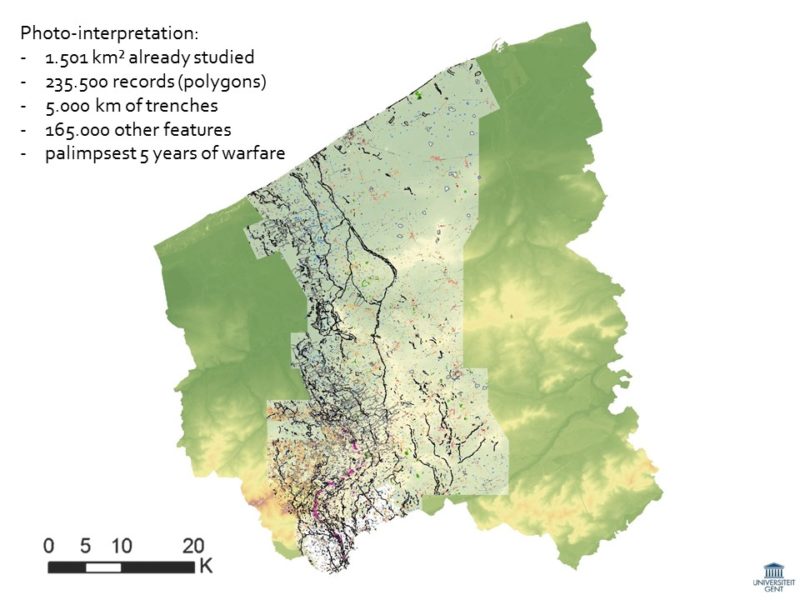
This methodology is the foundation for a study of the entire Belgian front zone in the interdisciplinary research project ‘Non-Invasive Landscape Archaeology of the Great War in Belgium’. Although the inventory of war features on our dataset of some 24,000 georectified aerial images coming from war archives worldwide is still ongoing, already 4875 km of trenches and over 165,000 of other military structures have been identified in the surveyed area of 1457 km², along a front line of only 67 km. In this paper, we will present a detailed study of the part of this conflict landscape using a transect through the shifting frontlines and both hinterland zones, showing the vast war infrastructure and consequent war destruction, and giving insights into their possible archaeological preservation.