(Applied Geography, 2016)
The First World War from above and below. Historical aerial photographs and mine craters in the Ypres Salient
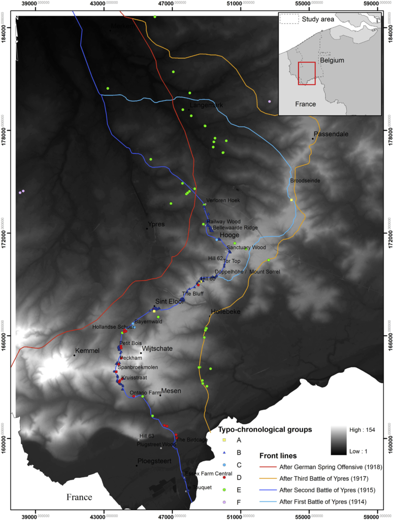
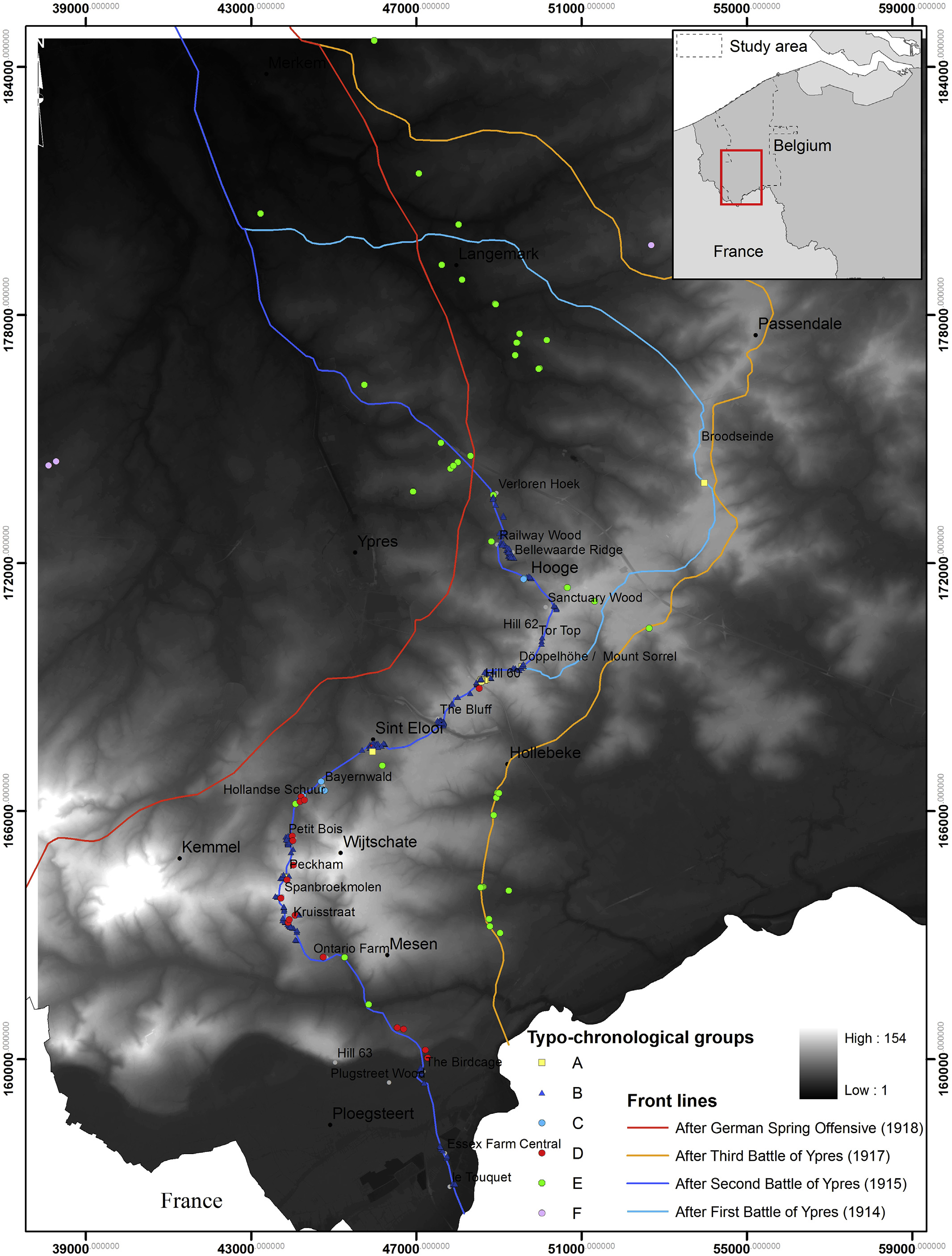
During the First World War, ancient siege techniques were used in an attempt to break through the stalemate in the trenches. This paper approaches the mine crater war from a completely new perspective and focuses on a landscape-scale approach rather than on fragmented individual sites. Thousands of contemporary aerial photographs have been used as a primary source of information to detect and understand the historical mine crater landscape along the former Western Front in Belgium. The paper presents a methodology for dating war features by means of a time series analysis of aerial photographs, confronting this historical landscape with a high-resolution Airborne Laser Scanning (ALS) dataset.
Reference:
Stichelbaut, B., Gheyle, W., Saey, T., Van Eetvelde, V., Van Meirvenne, M., Note, N., Van den Berghe, H. & Bourgeois, J. (2016). The First World War from above and below. Historical aerial photographs and mine craters in the Ypres Salient. Applied Geography, 66, 64-72. doi: http://dx.doi.org/10.1016/j.apgeog.2015.11.020