
(Archaeological Prospection, 2016)
Historical Aerial Photography and Multireceiver EMI Soil Sensing, Complementing Techniques for the Study of a Great War Conflict Landscape
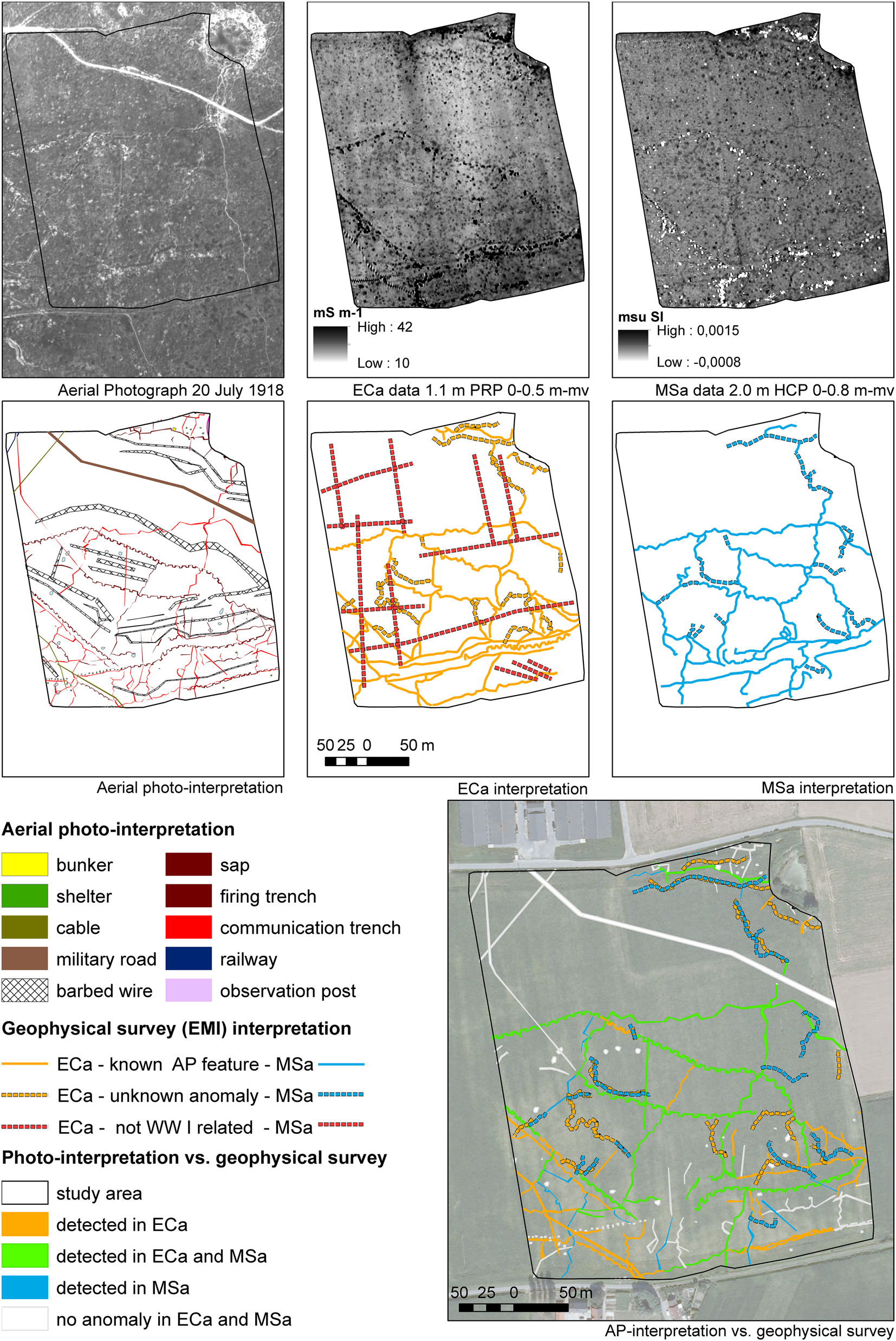
This paper examines the combination of historical aerial photographic evidence and geophysical soil sensing. A case study in Comines-Warneton compares data derived from contemporary WWI aerial photographs with multi-receiver electromagnetic induction surveys. This comparison provides an understanding of the degree of preservation of trenches, dugouts and other military structures, and illustrates the added value of integrating both techniques in an in-depth, non-invasive study of conflict landscapes.
Reference:
Gheyle, W., Saey, T., Van Hollebeeke, Y., Verplaetse, S., Note, N., Bourgeois, J., Van Meirvenne, M., Van Eetvelde, V. & Stichelbaut, B. (2016). Historical Aerial Photography and Multi-receiver EMI Soil Sensing, Complementing Techniques for the Study of a Great War Conflict Landscape. Archaeological Prospection, doi:10.1002/arp.1534